


Most of us have heard the word “azimuth” in adventure films or vaguely remember it from school geography. But what is it exactly? It’s a key concept in geodesy, navigation, astronomy, and cartography, used to define the exact direction to an object or location. We’ll explain what azimuth is, how it can be accurately determined using various methods, and in what units it is measured. This will likely help you better orient yourself in space and understand navigation processes.
What Is Azimuth, in What Units It Is Measured
By definition, azimuth is the horizontal angle formed at the observation point between two rays, one of which runs along the meridian (the line between the north and south poles), and the other connects the observation point with the observed object.
In school, we learned a simpler rule: azimuth is the angle between the direction to the north and a given object.
It is measured clockwise, either from the north or south pole, depending on the hemisphere, and ranges from 0 to 360 degrees. This applies to geography. However, in artillery and astronomy, measurements start from the south and are taken counterclockwise. We are discussing geographic azimuth, which is used for map orientation.
In what units is it measured? It’s an angle! Therefore, it is measured in degrees, like all angles!
But that’s not all. There are two types of azimuth: true and magnetic, depending on which meridian is used as the reference. It’s well known that the magnetic needle of a compass points to the magnetic pole, while maps show the geographic pole. Thus, the direction given by a compass is magnetic, and the direction to the geographic pole is true. The angle between them is called magnetic declination.
It may seem complicated at first, but in fact, topographic maps always show the magnetic declination at the bottom, making it easy to calculate the true azimuth if you know the magnetic one.
Why Is Azimuth Used
It is the foundation of map orientation. It may not be of much use to those who never leave the city and rely on GPS in their cars or phones. However, for travelers, military personnel, and anyone who frequently moves through uncharted routes and less-known paths not found on maps, knowing how to orient yourself is crucial.
To feel confident in unfamiliar areas, you need a topographic map, a compass, or at least a protractor – something we all remember from school.

How yo Determine Azimuth Using a Map
There are two common methods: using a protractor and using a compass. In the first case, the algorithm is as follows:
- Lay the map on a flat surface.
- Mark your location point – this will be the starting point for your measurement.
- Choose the point of interest.
- Connect both points with a straight line, extending it to the nearest meridian.
- Placing the protractor’s base along the meridian, measure clockwise the angle between the drawn line and the meridian. This is your geographic (true) azimuth.
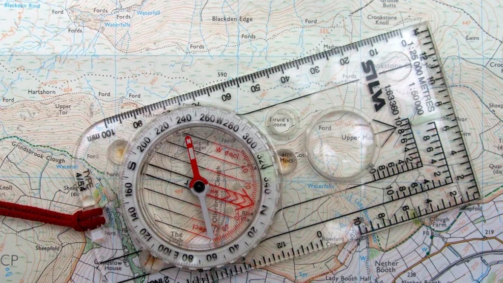
The process for the second method is as follows:
- Choose a direction of movement and a visible landmark (a tree, hill, road intersection, etc.).
- Face the direction of the landmark, holding the map and compass in front of you. Make sure there are no large metal objects nearby (like power line poles).
- Release the compass brake, allowing the needle to find the north pole. This applies to a traditional, classic compass. If you have an electronic one, follow the manufacturer’s instructions.
- Place the compass on the map and align the north markings.
- Using a ruler, draw a line towards the landmark.
- The angle between the compass needle’s direction and the drawn line is the magnetic azimuth. If necessary, convert it to geographic (true) azimuth.
How to Determine Azimuth in the Field
In the field, azimuth is determined based on a chosen direction or a designated landmark using a compass. Let’s explain this using a classic compass with a sight. You hold the compass, release the brake, and the needle begins to oscillate. After a short time, it will stop, pointing to the north. Rotate the body to align the needle with the letter N (or S) on the scale. Then, rotating the sight ring, find the target object in the “sight.” The sight’s position on the graduated scale (limb) indicates the magnetic azimuth to the selected landmark.
What Is Azimuth? Field Orientation – Video
To fully understand what azimuth is and how you can orient yourself in the field using it, watch the video:
Conclusion
Azimuth is a key parameter used to define the precise direction to an object relative to the north pole. It can be determined using a compass or protractor and is measured in degrees. While few of us encounter in daily life, this knowledge is critical for travelers, military personnel, and anyone needing navigation without modern electronic devices.
Frequently Asked Questions About Azimuth
It means finding the correct direction on a map using a compass and reaching the specified point.
We start counting from the north pole, so the direction exactly east will be 90°.
In the field, we orient ourselves using a compass, so we get the magnetic azimuth.
It indicates the direction directly south, as 180 degrees is the opposite direction from zero.